The 1980s Collection
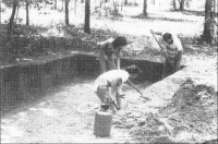
In the 1980s the Chicora Foundation did the first archaeology in what would become our Park. This project was the first to document the archaeology of Mitchelville and the researcher’s findings changed the way we understood American history. Read this Collection to learn more.
The Praise House Collection: I
In 2018 the Historic Mitchelville Freedom Park began the process of building a Master Plan for park development. One of the early goals was trying to locate the first Church or Praise House erected in Mitchelville. Read this Collection to learn more.
The Praise House Collection: II
Archaeologists returned to our Park in 2019 to pick up their research where they had left off the last season. using evidence they found over the winter, they opened up more excavations. Read this Collection to learn more.
Foundational Work
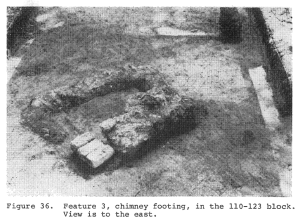
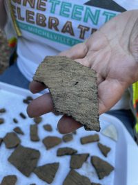
The archaeological story of Mitchelville began when construction work accidentally uncovered Native American artifacts near Coggins Creek. The Chicora Foundation’s archaeologists found over 25,000 artifacts from Mitchelville-era deposits, including Mitchelville homesites with intact hearths. This foundational work proved that Mitchelville residents were participating in a cash economy and acquiring higher status goods than they had previously owned during enslavement.
Project Highlights:
- Four major structural complexes excavated
- 25,000+ artifacts recovered
- Evidence of both indigenous Late Archaic occupation and Reconstruction-era Mitchelville
- Proof of residents’ improved material conditions post-emancipation
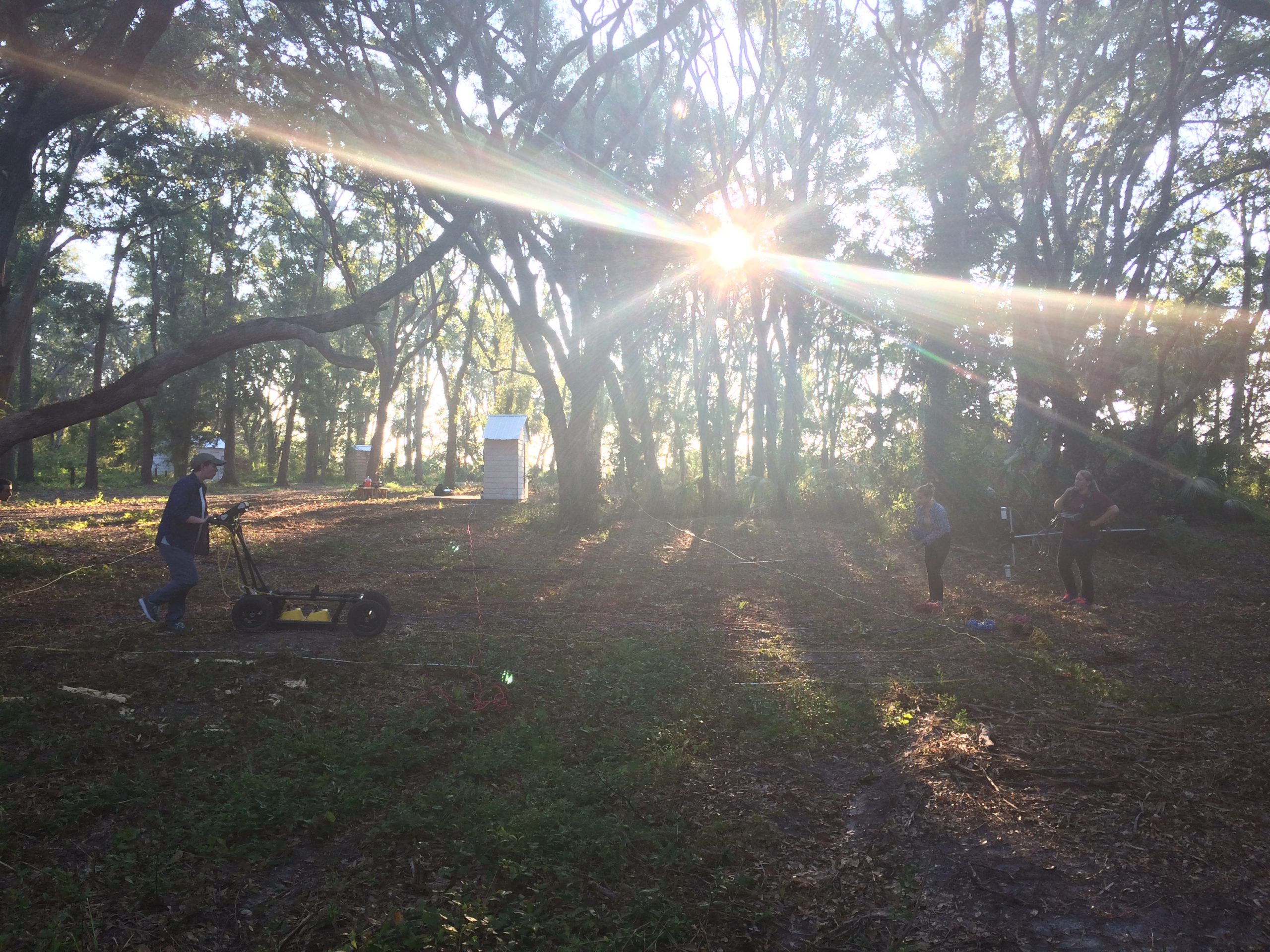
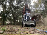
Remote Sensing in Search of the Praise House Begins
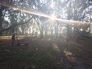
The modern era of archaeology at Mitchelville began with a small ground-penetrating radar survey to test the effectiveness of the equipment in the park's unique soil conditions. Although this initial work didn’t produce a large amount of data, it laid the foundation for future remote sensing strategies.
Praise House Survey and First Excavations
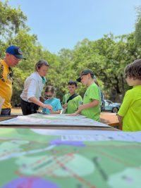
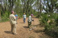
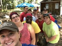
Using magnetometry and electrical resistivity, undergraduate and graduate student archaeologists identified places under the ground that were most likely to have evidence of a past building that led to targeted excavations. That summer, a field school (or summer archaeology class) worked to excavate areas around the old Praise House exhibit and worked hard build relationships with local community members who came to visit the excavations.
Project Highlights:
- Remote sensing survey using magnetometry and electrical resistivity
- Community-based participatory research approach
- PhotoVoice documentation of the archaeological experience
- Complete documentation available in digital archive
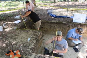
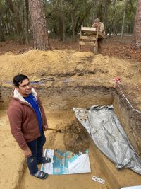
Second Praise House Excavations and Community Building
Building on 2018 discoveries, archaeologists expanded excavation areas and implemented the first visitor survey program to understand how different communities connected with Mitchelville's story. This work also included ethnographic interviews with multi-generational Gullah Geechee islanders. The project recovered hundreds of Mitchelville era artifacts and strong evidence of a building footprint.
Project Highlights:
- Extended excavations in multiple operations
- First visitor survey program implemented
- Ethnographic interviews with community elders
- Evidence of both Mitchelville and indigenous Late Archaic occupation
Remote Sensing Historic Mitchelville: Connecting the Dots
Archive Coming Soon
The COVID-19 pandemic shifted focus to comprehensive remote sensing across the entire park. This $50,000 matching grant project aimed to assess all heritage resources before any development, establishing HMFP as a leader in heritage preservation planning.
Project Highlights:
- First comprehensive park-wide archaeological assessment
- Integration of advanced remote sensing technologies
- Foundation for sustainable heritage management planning
- Model for other historical sites nationwide
Ghost Structure Archaeology Project: Connecting the Dots
Connecting the Dots
*Before our Ghost Structure Exhibit could be built, we needed to know where Mitchelville buildings were in the past, and were there any clues left behind to help us learn about Mitchelville residents?
Archaeological investigations continued as HMFP prepared for construction of their new Visitor Center. These surveys ensured that all significant archaeological deposits would be properly documented and preserved before any development.
Project Highlights:
- Targeted excavations of areas where Ghost Structure Buildings were erected
- Investigations of Historic Mitchelville era yard spaces
- Providing information to incorporate into Ghost Structure Exhibit
- Understanding Native American Woodland site usage better
ARFA Building Archaeology Project: Echoes Through Time
The first building we are erecting in the Park is our Archaeological Research Facility and Auditorium. But before laying its foundations, we had to examine the ground beneath it for evidence of past people.
Project Highlights:
- Investigate fully the area that would become the ARFA Building
- Find evidence about Historic Mitchelville yard spaces
- Find evidence about Native American Archaic usage of the site
- Investigate in a more in-depth manner multi-site occupations of Historic Mitchelville
Interpretive Center Archaeology: Stories Surround Us
The Interpretive Center will be the heart of Historic Mitchelville Freedom Park, welcoming in our visitors and helping tell the story of our past. But it may have been the heart of another community in the past too. Our archaeologists are working to learn more.
Project Focus:
- Investigate deeply buried Native American evidence below where our Interpretive Center will be located
- Fully clear area destined for Interpretive Center of archaeological evidence before development occurs